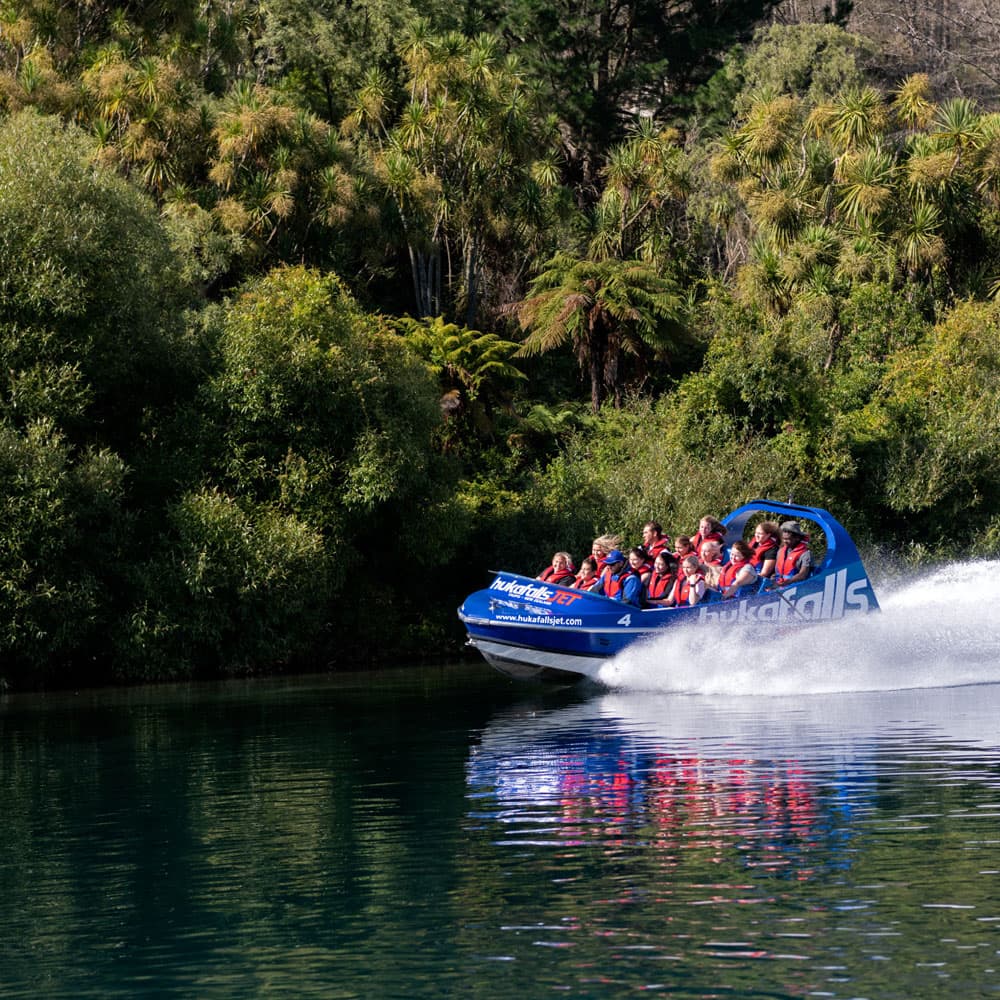
Huka Falls
About Huka Falls & Lake Taupō
Huka Falls
Huka means "foam" in Maori.
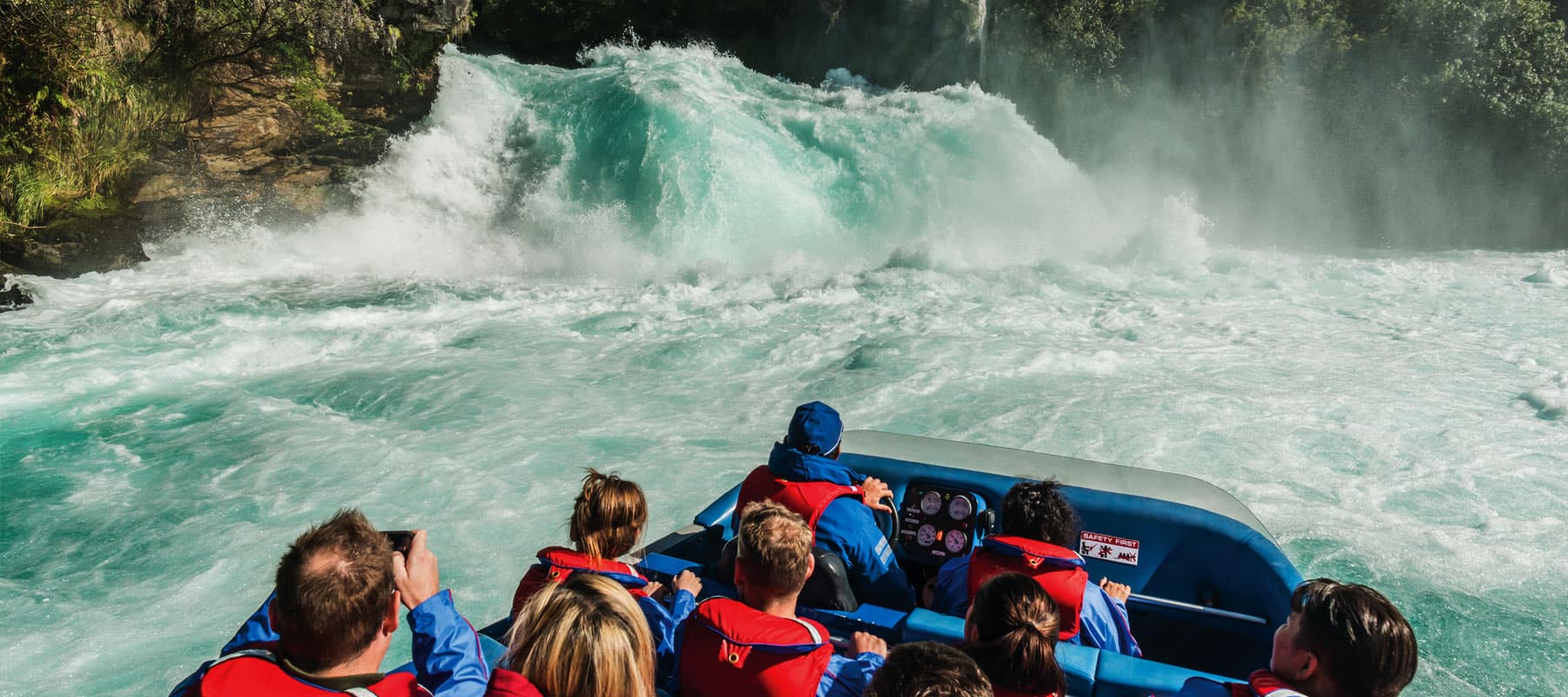
The Huka Falls is regarded as one of New Zealand's most spectacular and most visited natural attractions.
Huka Falls are created by water that has flowed through a wide riverbed around 100 metres wide and four metres deep, that is then confined to a narrow river section about 15 metres in width and 10 metres deep.
At the top of the falls is a set of small waterfalls dropping over about eight metres. However, the most impressive part of the Huka Falls is watching extensive amounts of water flow over a cliff 11 metres (35 ft) high.
The flow over the Huka Falls fluctuates between 32 and 270 cubic metres per second. On average the daily flow over the falls is 160 cubic metres per second. Depending on the flow of water, the height of the falls fluctuates between seven and nine and a half metres.
The unique blue colour of the water at the base of the falls is created by the clear water reflecting the blue light and the air bubbles in the water intensifying the colour further.
Lake Taupō
More than 30 rivers and streams flow into Lake Taupo, with only one outlet - the Waikato River.
Lake Taupo is the largest lake in New Zealand spanning about 622 km²; this is about the size of Singapore. Lake Taupo was formed by a series of eruptions. The main Taupo eruption occurred in 181AD. The most documented eruption in the Lake Taupo area is known as the Oranui eruption.
The Oranui eruption
The Oranui eruption caused some distinct changes in the landscape of the Taupo area. The most obvious of these changes being the distribution of lakes in the area, and the course of the Waikato River.
Prior to the Oranui eruption a lake existed in a different form, this lake is referred to as Lake Huka, and the Waikato River is documented to have run out to the Pacific Ocean via the Hauraki Gulf basin.
After the Oranui eruption the landscape was changed significantly, after a period of flooding, the form of the modern Lake Taupo started to take shape.
Over the years after the Oruanui eruption the course of the Waikato River changed to follow its current route along the Hamilton basin and out into the Tasman Sea.
Currently the volcano is said to be dormant, however not extinct. According to geological records, the volcano now known as Lake Taupo has erupted 28 times in the last 27,000 years.
The full name of the Lake is Taupo-nui-a-Tia, which means the great cloak of Tia. Tia an ancestor of the Ngati Tuwharetoa tribe, the main iwi of the area, was the first to come across the eastern side of Taupo.
Legends documenting Tia's great quest, suggest that Tia named the lake after he saw a rock formation that resembled his heavy cloak, he then hung this cloak, or taupo, on a post and claimed the area as Taupo nui a Tia, which means the Great Cloak of Tia.
Waikato River
Waikato is a Maori word meaning "flowing water".
The Waikato River is the longest river in New Zealand, with a distance of 434 km.
The Lake Taupo control gate bridge controls the level of the Waikato River. The flow of the river is increased to meet high electricity demands during the day and early evening, overnight the flow the flow generally drops as electricity demand reduces.
The Waikato River is host to eleven power stations. These plants produce about 65% of the North Island's power, and about 25% of New Zealand's hydropower. Overall these eleven stations produce 15 % of New Zealand's total power.
Wairakei Power Station
The Wairakei power station is the second power station in the world to turn natural steam into energy. Wairakei was however the first power station to utilise wet steam energy. The Wairakei power station runs at 95% capacity, and supplies around 3.5% of New Zealand's power.
Aratiatia Dam
Aratiatia in Maori means "the stairway of Tia". This name originating from the rapids below the dam, which resemble a series of steps.
The Aratiatia hydro station is supplied from tunnels in the dam at the top of the rapids, and generates around 90MW of power.
Combos